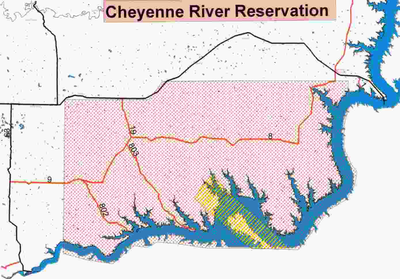
Armstrong County
Gunnery Range Program
Gunnery Range Program
The Cheyenne River Sioux Tribe has prepared a Strategic Project Implementation Plan (SPIP) for the mitigation of impacts to the portion of their Reservation used as a gunnery range by the Army during World War II. The Plan is presented to the United States Department of Defense as part of the Native American Lands Environmental mitigation Program (NALEMP) requirements for continued support and funding.
The SPIP has incorporated historical events and findings of scientific research to describe the condition of the land and habitat on the former Armstrong County Air-to-Air Gunnery Range. It tells the sequence of events that resulted in damage to the land and habitat conditions substantially below the standards expected for the site. The SPIP proposes remedies and a plan of action to achieve restoration of the land and habitat. It also describes a cooperative approach, leveraging other resources to make this mitigation a reality and a benefit to many Tribal members.
Armstrong County Gunnery Range 396,360 Acres
The former Range is a very large tract of land, about 625 square miles. It represents about 29 percent of block the Reservation's trust land. For comparison, it is about half the size of the state of Rhode Island. The diagonal across the former Range is approximately 40 miles, the distance from Washington D.C. to Baltimore.
Today, the lands of the former Range sharply contrast the other lands of the reservation. On the Gunnery Range the drainages to the Cheyenne and Missouri Rivers are severely eroded and barren of vegetation compared to healthy riparian habitat along similarly situated drainages on the rest of the Reservation. The populations of many wildlife species are less than on the other parts of the Reservation. In addition, .50 caliber shells are dispersed throughout the near surface soils.
The historical record documents that the drought of the 1930s caused erosion throughout the area, including the land that later would be used as the Gunnery Range. In the late 1930s and in the 1940s conservation programs directed by Federal, State and local governments were implemented to assist in land recovery to restore the lands to the pre-drought conditions. Unfortunately, during the critical time for land restoration, 1943-1947, the lands of the Gunnery Range were leased to the War Department, conservation practices were not implemented, and the eroded and barren drainages did not recover from the drought years. In addition, the ordnance was never cleared from the land.
Tribal members experienced emotional, cultural, and economic impacts and losses from dislocation and restricted access to their land during the Gunnery Range years, from the continuing fear of exploding ordnance, and from the damage to their land and vegetation. The safety concerts of spent and live ammunition found in the surface soils have prevented farming the land and free access to religious and culturally significant sites. The unchecked erosion on the Gunnery Range has resulted in sediment loading into the Cheyenne and Missouri Rivers, loss of riparian habitat, damage to the composition of native grasses, and loss and i mpaired growth of native plants that are used in cultural and religious ceremonies and for medicinal practices.
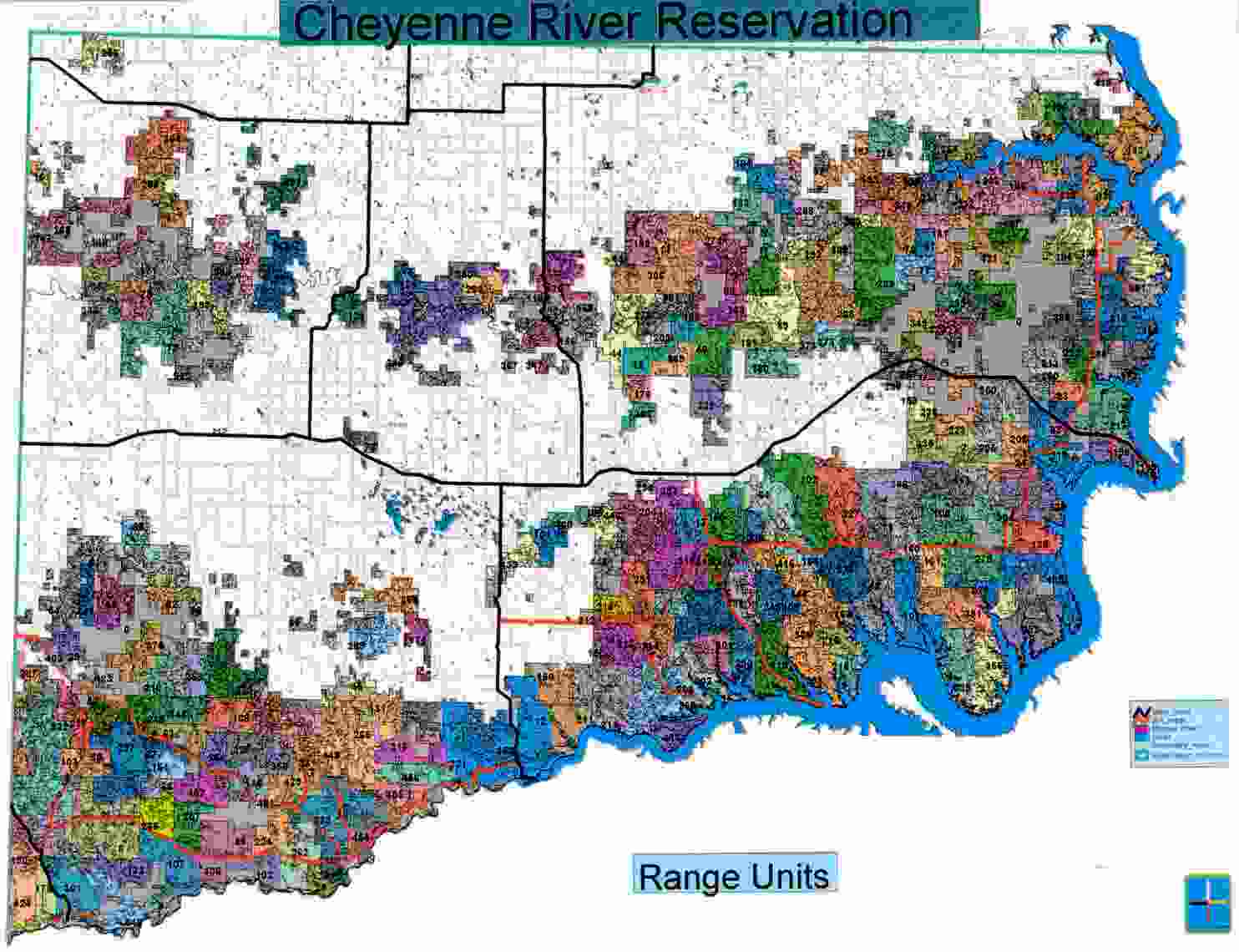
Cheyenne River Sioux Tribe Range Units
The mitigation actions for the Gunnery Range activities are estimated to cost $173 million and are scheduled for completion over ten years. Work to mitigate the impacts includes munitions removal, environmental restoration and monitoring, economic compensation and cultural restoration. Removal of munitions from the tillable land, cultural sites and the area of overlap of the Bombing Range onto the Gunnery Range is necessary for agricultural development and mitigation of cultural losses.
Restoring native medicine and food plants, repairing and re-consecration of sacred and ceremonials sites and preserving historic sites will provide the cultural healing and education necessary to restore pride and fully utilize the resources that the Gunnery Range provides to the Tribe. Environmental mitigation will achieve erosional control and riparian restoration.
The improved habitat will benefit populations of endangered species, such the interior least tern and the piping plover, several species of Tribal concern that are suffering because of damaged habitat, and populations of wildlife and native game animals Control of erosion and restoring the riparian habitat in the drainages leading to the Cheyenne and Missouri Rivers is essential to the success of resource development and management planned in the Oahe Mitigation Bill. Economic mitigation will compensate the Tribe for unpaid relocation expenses, inequitable lease payments, and loss of full use of the land.
The Tribe plans to seek the cooperative efforts of other Tribal projects and federal agencies. In doing so it expects to leverage on-going work in related local areas. The Tribe will start a tribally-owned business to design and implemented the restoration work. An outreach plan will be developed to involve Tribal members. Restoration of the habitat on the Gunnery Range will provide multiple economic benefits to the tribe.
In addition to the new tribally-owned business, the Tribe will see improvements in their water development a nd irrigation systems, in fisheries, in commercial hunting and in cultural tourism. The SPIP is a road map for the Tribe and the Department of Defense to mitigate the impacts from the use of the Reservation as a Gunnery Range. Restoring the damaged land and habitat will return much of the economic basis for sustenance to the Tribe It should be pursued and funded will the full support of the Administration and Congress.